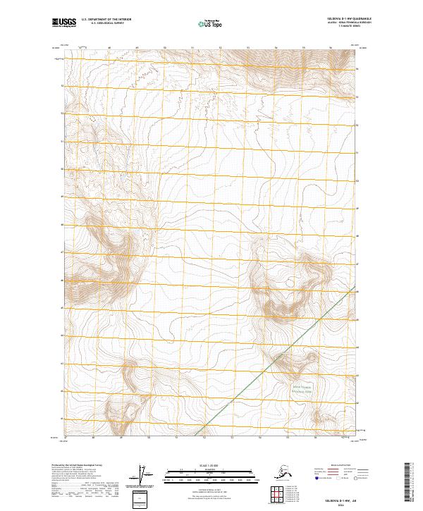
2024 Map of Seldovia D-1 NW
USGS Topo · Published 2024About this map
Kenai National Wildlife Refuge dominates this stretch of the Kenai Peninsula, showcasing a landscape defined by preservation and extreme topography. The map illustrates a complex convergence of jurisdictional boundaries where the wildlife refuge meets the Kenai Wilderness (Andrew Simons Unit) and the Kenai Fjords National Park. The steep contour lines indicate a transition from high alpine elevations down toward the coastal influence of the fjords. This 2024 edition provides a precise look at the modern administrative divisions of the Alaska wilderness, highlighting how these protected lands are managed as contiguous units of the National Preservation System.
Find a feature on this map
7 named features on this map. Tap any name to fly to it.
Don’t see what you’re looking for? This feature index may not catch every label — zoom into the map to look around manually.
Map Details
Editions of this 2024 Seldovia D-1 NW Map
This is the sole edition of this map. No revisions or reprints were ever made.
Other maps of this area

1944 · Kenai
USGS Topo · 1:250,000

1950 · Kenai
USGS Topo · 1:250,000

1950 · Seldovia D-2
USGS Topo · 1:63,360

1951 · Seldovia
USGS Topo · 1:250,000

1951 · Kenai A-2
USGS Topo · 1:63,360

1951 · Kenai A-1
USGS Topo · 1:63,360

1951 · Seldovia D-1
USGS Topo · 1:63,360

1952 · Kenai A-1
USGS Topo · 1:63,360

1952 · Kenai A-2
USGS Topo · 1:63,360

1953 · Seldovia D-2
USGS Topo · 1:63,360