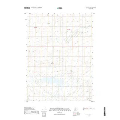
2018 Map of Seldovia D-3 NW
USGS Topo · Published 2018About this map
Caribou Lake sits as a central hydrological feature within the interior of the Kenai Peninsula, surrounded by the high-elevation terrain of the Caribou Hills and the Boxcar Hills. This 2018 survey documents a remote landscape defined by its upland plateaus and drainage networks, where Ptarmigan Head rises as a prominent landmark in the north. The area's complex hydrology is evidenced by the headwaters of Cytex Creek and Deep Creek, which carve through the elevations. The map reveals an absence of modern road infrastructure, highlighting the area's character as a wilderness expanse. The grid of the Public Land Survey System provides the primary structural framework across these hills, indicating a region mapped for its natural resources and terrain rather than human settlement.
Find a feature on this map
11 named features on this map. Tap any name to fly to it.
Don’t see what you’re looking for? This feature index may not catch every label — zoom into the map to look around manually.
Map Details
Editions of this 2018 Seldovia D-3 NW Map
This is the sole edition of this map. No revisions or reprints were ever made.
Other maps of this area

1944 · Kenai
USGS Topo · 1:250,000

1949 · Seldovia D-4
USGS Topo · 1:63,360

1950 · Kenai
USGS Topo · 1:250,000

1951 · Seldovia D-4
USGS Topo · 1:63,360

1951 · Seldovia
USGS Topo · 1:250,000

1951 · Seldovia D-3
USGS Topo · 1:63,360

1951 · Kenai A-3
USGS Topo · 1:63,360

1951 · Kenai A-4
USGS Topo · 1:63,360

1952 · Kenai A-3
USGS Topo · 1:63,360

1952 · Kenai A-4
USGS Topo · 1:63,360