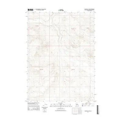
2014 Map of Seldovia D-4 NE
USGS Topo · Published 2014About this map
The Caribou Hills dominate this portion of the Kenai Peninsula, showcasing a high-altitude drainage system defined by the headwaters of several major waterways. This 2014 survey captures the untouched landscape before it transitions toward the more settled coastal areas. The drainage pattern is led by the winding path of Deep Creek, which is joined by high-elevation tributaries including North Fork Deep Creek and Cytex Creek. In the southwestern corner, the South Fork Deep Creek begins its descent through the upland terrain. This map is a critical resource for understanding the hydrological structure of the borough, illustrating how these streams carve through the ridgelines and valleys of the hills, far removed from the road networks of the surrounding lowlands.
Find a feature on this map
9 named features on this map. Tap any name to fly to it.
Don’t see what you’re looking for? This feature index may not catch every label — zoom into the map to look around manually.
Map Details
Editions of this 2014 Seldovia D-4 NE Map
This is the sole edition of this map. No revisions or reprints were ever made.
Other maps of this area

1944 · Kenai
USGS Topo · 1:250,000

1949 · Seldovia D-4
USGS Topo · 1:63,360

1950 · Kenai
USGS Topo · 1:250,000

1951 · Seldovia D-4
USGS Topo · 1:63,360

1951 · Seldovia
USGS Topo · 1:250,000

1951 · Seldovia D-3
USGS Topo · 1:63,360

1951 · Kenai A-3
USGS Topo · 1:63,360

1951 · Kenai A-4
USGS Topo · 1:63,360

1952 · Kenai A-3
USGS Topo · 1:63,360

1952 · Kenai A-4
USGS Topo · 1:63,360