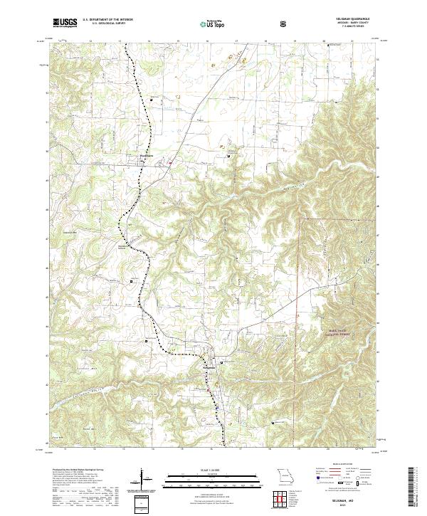
2021 Map of Seligman
USGS Topo · Published 2021About this map
Seligman and Washburn anchor this Barry County landscape, where the Ozark plateau drops into a complex system of ridges and hollows. The area is defined by sharp topographic shifts, from the heights of Oakleigh Mtn and Lennox Mtn to the depths of Dry Hollow and Seligman Hollow. This 2021 survey documents the persistent rural character of southwest Missouri, with numerous family and community burial grounds like Washburn Prairie Cem, Riley Cem, and Burnett Cem scattered throughout the territory. The eastern portion of the map is dominated by the protected woodlands of the Mark Twain National Forest, while the drainage of Big Sugar Cr and Butler Cr shapes the southern valley floors. A network of Forest Service roads and farm-to-market routes connects these high ridges, reflecting a landscape where local geography continues to dictate settlement and transport patterns.
Find a feature on this map
68 named features on this map. Tap any name to fly to it.
Don’t see what you’re looking for? This feature index may not catch every label — zoom into the map to look around manually.
Map Details
Editions of this 2021 Seligman Map
This is the sole edition of this map. No revisions or reprints were ever made.
Other maps of this area

1899 · Fayetteville
USGS Topo · 1:125,000

1900 · Eureka Springs
USGS Topo · 1:125,000

1901 · Eureka Springs
USGS Topo · 1:125,000

1901 · Fayetteville
USGS Topo · 1:125,000

1904 · Fayetteville
USGS Topo · 1:125,000

1937 · Cassville
USGS Topo · 1:48,000

1941 · Rocky Comfort
USGS Topo · 1:62,500

1943 · Rocky Comfort
USGS Topo · 1:62,500

1944 · Cassville
USGS Topo · 1:62,500

1945 · Harrison
USGS Topo · 1:250,000