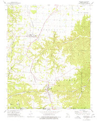
1974 Map of Seligman
USGS Topo · Published 1977About this map
The St Louis-San Francisco railroad serves as the central artery for this mid-1970s study of the Missouri-Arkansas border region. The settlements of Washburn and Seligman anchor the rail line, surrounded by a landscape defined by sharp transitions from the Flat Creek lowlands to the elevated terrain of Oakleigh Mountain and Lennox Mountain. Evidence of early community life is preserved through numerous family and country burial grounds, including the Washburn Prairie Cem, Riley Cem, and King Cem. To the east, the Mark Twain National Forest encompasses the high ground of Long Hollow and Ridge. The map provides a high level of detail for genealogists, identifying rural landmarks such as Salem Ch, Corinth Ch, and the secluded McCann Cave near the Arkansas state line.
Find a feature on this map
41 named features on this map. Tap any name to fly to it.
Don’t see what you’re looking for? This feature index may not catch every label — zoom into the map to look around manually.
Map Details
Editions of this 1974 Seligman Map
This is the sole edition of this map. No revisions or reprints were ever made.
Other maps of this area

1899 · Fayetteville
USGS Topo · 1:125,000

1900 · Eureka Springs
USGS Topo · 1:125,000

1901 · Eureka Springs
USGS Topo · 1:125,000

1901 · Fayetteville
USGS Topo · 1:125,000

1904 · Fayetteville
USGS Topo · 1:125,000

1937 · Cassville
USGS Topo · 1:48,000

1941 · Rocky Comfort
USGS Topo · 1:62,500

1943 · Rocky Comfort
USGS Topo · 1:62,500

1944 · Cassville
USGS Topo · 1:62,500

1945 · Harrison
USGS Topo · 1:250,000