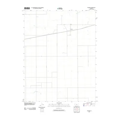
2010 Map of Selkirk
USGS Topo · Published 2010About this map
Selkirk stands as a focal point in the western Kansas High Plains, situated in Greeley County along the primary corridor of State Hwy 96. This rural landscape is defined by the high, flat topography typical of the region, where the section-line road network, including Co Rd 2 and Co Rd P, dictates the pattern of agricultural life and transit. The winding path of White Woman Creek provides a rare break in the geometric grid of the township, cutting across the northern portion of the quadrangle. For those researching local lineages or the history of the Tribune Township area, the Selkirk Cemetery remains a key landmark north of the town site, anchoring the small community to its 19th-century roots and providing a tangible link to the families who settled this high-desert prairie.
Find a feature on this map
13 named features on this map. Tap any name to fly to it.
Don’t see what you’re looking for? This feature index may not catch every label — zoom into the map to look around manually.
Map Details
Editions of this 2010 Selkirk Map
This is the sole edition of this map. No revisions or reprints were ever made.
Other maps of this area

1955 · Scott City
USGS Topo · 1:250,000

1958 · Scott City
USGS Topo · 1:250,000

1968 · Russell Springs 3 SW
USGS Topo · 1:24,000

1970 · Selkirk SW
USGS Topo · 1:24,000

1970 · Sharon Springs 4 SE
USGS Topo · 1:24,000

1970 · Sharon Springs 4 SW
USGS Topo · 1:24,000

1970 · Selkirk SE
USGS Topo · 1:24,000

1970 · Selkirk
USGS Topo · 1:24,000

1970 · Leoti NW
USGS Topo · 1:24,000

1970 · Selkirk NW
USGS Topo · 1:24,000