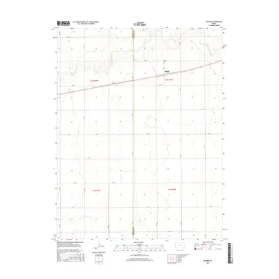
2015 Map of Selkirk
USGS Topo · Published 2015About this map
Selkirk serves as the primary settlement hub on this High Plains survey, positioned along the county line where Greeley County and Wichita County meet. The township is characterized by a precise grid of rural roads, including Main St and County Road 3, which support a vast agricultural landscape. Local history is anchored by the Selkirk Cem, located just north of the town center. The natural geography is defined by the ephemeral drainage of White Woman Cr, which meanders across the northern and southern sections of the quadrangle. This 2015 data reflects the enduring structural layout of western Kansas, where transportation corridors like the road labeled County Road Q follow the straight lines of the Public Land Survey System through T18S and T19S.
Find a feature on this map
24 named features on this map. Tap any name to fly to it.
Don’t see what you’re looking for? This feature index may not catch every label — zoom into the map to look around manually.
Map Details
Editions of this 2015 Selkirk Map
This is the sole edition of this map. No revisions or reprints were ever made.
Other maps of this area

1955 · Scott City
USGS Topo · 1:250,000

1958 · Scott City
USGS Topo · 1:250,000

1968 · Russell Springs 3 SW
USGS Topo · 1:24,000

1970 · Selkirk SW
USGS Topo · 1:24,000

1970 · Sharon Springs 4 SE
USGS Topo · 1:24,000

1970 · Sharon Springs 4 SW
USGS Topo · 1:24,000

1970 · Selkirk SE
USGS Topo · 1:24,000

1970 · Selkirk
USGS Topo · 1:24,000

1970 · Leoti NW
USGS Topo · 1:24,000

1970 · Selkirk NW
USGS Topo · 1:24,000