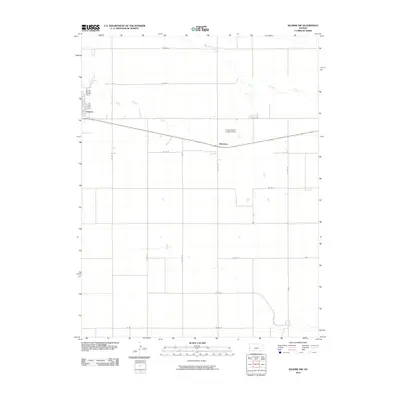
2010 Map of Selkirk NW
USGS Topo · Published 2010About this map
Tribune sits at the western edge of this High Plains landscape, where the town's street grid meets the expansive agricultural section lines of Greeley County. The terrain is defined by the winding course of White Woman Creek, which cuts an irregular path across the northern half of the quadrangle, contrasting with the rigid geometry of the surrounding county roads. A small settlement at Whitelaw marks a point of activity along the central roadway, while the Pringle Ranch Landing Field provides a specialized aviation landmark within the rural interior. The map illustrates a classic Great Plains settlement pattern, where infrastructure like Co RD 17 and Co RD O follows the Public Land Survey System to organize the high desert prairie into a productive ranching and farming mosaic.
Find a feature on this map
18 named features on this map. Tap any name to fly to it.
Don’t see what you’re looking for? This feature index may not catch every label — zoom into the map to look around manually.
Map Details
Editions of this 2010 Selkirk NW Map
This is the sole edition of this map. No revisions or reprints were ever made.
Other maps of this area

1955 · Scott City
USGS Topo · 1:250,000

1958 · Scott City
USGS Topo · 1:250,000

1970 · Selkirk SW
USGS Topo · 1:24,000

1970 · Sharon Springs 4 SE
USGS Topo · 1:24,000

1970 · Sharon Springs 3 SE
USGS Topo · 1:24,000

1970 · Sharon Springs 4 SW
USGS Topo · 1:24,000

1970 · Selkirk SE
USGS Topo · 1:24,000

1970 · Selkirk
USGS Topo · 1:24,000

1970 · Selkirk NW
USGS Topo · 1:24,000

1970 · Tribune SE
USGS Topo · 1:24,000