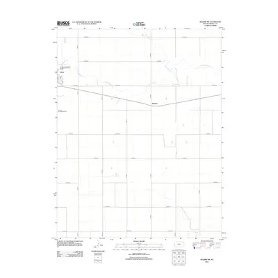
2012 Map of Selkirk NW
USGS Topo · Published 2012About this map
Tribune sits on the western edge of this High Plains landscape, serving as a vital hub for the surrounding agricultural prairie. The town's layout is clearly defined by local streets such as Salina St, 4th St, and Park Ln, while essential infrastructure like the Tribune Municipal Airport and the Tribune Wastewater Treatment Facility supports the local population. The semi-arid character of the region is punctuated by the winding path of White Woman Cr, which meanders eastward through the northern portion of the quadrangle. Moving away from the concentrated center of Tribune, the map reveals a vast, grid-based network of county roads including Co Road O, Co Rd-17, and Co Road S. The small settlement of Whitelaw appears along the highway corridor, illustrating the dispersed nature of human habitation in this corner of Greeley County during the early 21st century.
Find a feature on this map
22 named features on this map. Tap any name to fly to it.
Don’t see what you’re looking for? This feature index may not catch every label — zoom into the map to look around manually.
Map Details
Editions of this 2012 Selkirk NW Map
This is the sole edition of this map. No revisions or reprints were ever made.
Other maps of this area

1955 · Scott City
USGS Topo · 1:250,000

1958 · Scott City
USGS Topo · 1:250,000

1970 · Selkirk SW
USGS Topo · 1:24,000

1970 · Sharon Springs 4 SE
USGS Topo · 1:24,000

1970 · Sharon Springs 3 SE
USGS Topo · 1:24,000

1970 · Sharon Springs 4 SW
USGS Topo · 1:24,000

1970 · Selkirk SE
USGS Topo · 1:24,000

1970 · Selkirk
USGS Topo · 1:24,000

1970 · Selkirk NW
USGS Topo · 1:24,000

1970 · Tribune SE
USGS Topo · 1:24,000