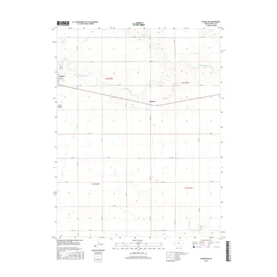
2015 Map of Selkirk NW
USGS Topo · Published 2015About this map
Tribune serves as the primary hub of this High Plains landscape, situated along the western edge of the Greeley County quadrangle. The town's grid is detailed down to residential streets like Greeley Ave and 4th St, providing a clear record of local property development and municipal organization in the modern era. To the southwest, the Tribune Municipal Airport anchors the region's transportation infrastructure, while the ephemeral path of White Woman Cr meanders eastward across the northern townships. The settlement of Whitelaw is situated further east along the highway, marking a distinct point of interest for those tracing the history of small rail-side communities in western Kansas. The surrounding terrain is defined by a dense network of county roads, including Co Rd 17 and Co Rd 20, which divide the land into the large rectangular sections typical of the region's agricultural economy.
Find a feature on this map
27 named features on this map. Tap any name to fly to it.
Don’t see what you’re looking for? This feature index may not catch every label — zoom into the map to look around manually.
Map Details
Editions of this 2015 Selkirk NW Map
This is the sole edition of this map. No revisions or reprints were ever made.
Other maps of this area

1955 · Scott City
USGS Topo · 1:250,000

1958 · Scott City
USGS Topo · 1:250,000

1970 · Selkirk SW
USGS Topo · 1:24,000

1970 · Sharon Springs 4 SE
USGS Topo · 1:24,000

1970 · Sharon Springs 3 SE
USGS Topo · 1:24,000

1970 · Sharon Springs 4 SW
USGS Topo · 1:24,000

1970 · Selkirk SE
USGS Topo · 1:24,000

1970 · Selkirk
USGS Topo · 1:24,000

1970 · Selkirk NW
USGS Topo · 1:24,000

1970 · Tribune SE
USGS Topo · 1:24,000