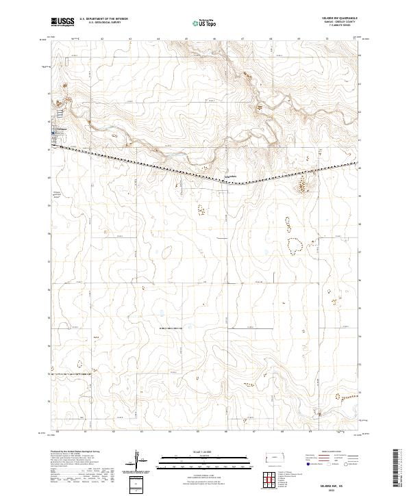
2022 Map of Selkirk NW
USGS Topo · Published 2022About this map
Tribune sits at the western edge of this High Plains landscape, where the rectangular grid of Greeley County meets the intermittent course of White Woman Cr. The terrain is defined by a rigorous network of section-line roads, including Co RD 17 and Co RD Q, reflecting the enduring agricultural organization of the region. Near the center of the sheet, the small settlement of Whitelaw is situated along the east-west corridor, serving as a localized point of interest in an otherwise expansive rural area. The presence of the Tribune Municipal Airport southwest of the main town underscores the importance of regional connectivity in this portion of western Kansas. Researchers can observe how the land is partitioned across several townships, including t18s r40w and t19s r39w, showing the systematic development of the plains during the early twenty-first century.
Find a feature on this map
23 named features on this map. Tap any name to fly to it.
Don’t see what you’re looking for? This feature index may not catch every label — zoom into the map to look around manually.
Map Details
Editions of this 2022 Selkirk NW Map
This is the sole edition of this map. No revisions or reprints were ever made.
Other maps of this area

1955 · Scott City
USGS Topo · 1:250,000

1958 · Scott City
USGS Topo · 1:250,000

1970 · Selkirk SW
USGS Topo · 1:24,000

1970 · Sharon Springs 4 SE
USGS Topo · 1:24,000

1970 · Sharon Springs 3 SE
USGS Topo · 1:24,000

1970 · Sharon Springs 4 SW
USGS Topo · 1:24,000

1970 · Selkirk SE
USGS Topo · 1:24,000

1970 · Selkirk
USGS Topo · 1:24,000

1970 · Selkirk NW
USGS Topo · 1:24,000

1970 · Tribune SE
USGS Topo · 1:24,000