
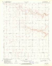
1970 Map of Selkirk SE
USGS Topo · Published 1971About this map
The High Plains of western Kansas are defined here by a vast grid of section lines and township boundaries where four counties—Greeley, Wichita, Hamilton, and Kearny—converge. Surveyed in 1970, the landscape is organized into distinct townships including Harrison, Whitewoman, Richland, and West Hibbard. The economy of the era is evident in the infrastructure of resource extraction and water management, notably with a Pipeline cutting across the southern terrain and several Oil Wells positioned near the county borders. A small Cem and a Spillway Elev 3429 offer specific points of interest for local historians, reflecting the sparse but deliberate human footprint in this semi-arid region during the late 20th century.
Find a feature on this map
13 named features on this map. Tap any name to fly to it.
Don’t see what you’re looking for? This feature index may not catch every label — zoom into the map to look around manually.
Map Details
Editions of this 1970 Selkirk SE Map
This is the sole edition of this map. No revisions or reprints were ever made.
Other maps of this area

1955 · Scott City
USGS Topo · 1:250,000

1958 · Scott City
USGS Topo · 1:250,000

1965 · Leoti 3 NW
USGS Topo · 1:24,000

1966 · Tribune 4 NW
USGS Topo · 1:24,000

1966 · Tribune 4 NE
USGS Topo · 1:24,000

1970 · Selkirk SW
USGS Topo · 1:24,000

1970 · Selkirk
USGS Topo · 1:24,000

1970 · Leoti NW
USGS Topo · 1:24,000

1970 · Selkirk NW
USGS Topo · 1:24,000
1970 · Leoti SW
USGS Topo · 1:24,000