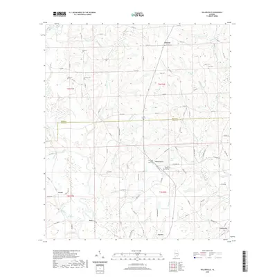
2020 Map of Sellersville
USGS Topo · Published 2020About this map
The Pea River and its numerous tributaries, including Little Rocky Cr, Holley Mill Cr, and Samson Br, carve a dense drainage network across this portion of Southeast Alabama. The landscape is defined by its small rural communities and family-named landmarks, reflecting a deep-rooted agricultural and social history. Notable congregational sites such as the Piney Grove Baptist Church and its neighboring Piney Grove Assembly of God serve as central points for the community of Piney Grove.
Find a feature on this map
108 named features on this map. Tap any name to fly to it.
Don’t see what you’re looking for? This feature index may not catch every label — zoom into the map to look around manually.
Map Details
Editions of this 2020 Sellersville Map
This is the sole edition of this map. No revisions or reprints were ever made.
Other maps of this area

1942 · Enterprise
USGS Topo · 1:125,000

1950 · Enterprise
USGS Topo · 1:62,500

1953 · Andalusia
USGS Topo · 1:250,000

1953 · Dothan
USGS Topo · 1:250,000

1954 · Dothan
USGS Topo · 1:250,000

1955 · Dothan
USGS Topo · 1:250,000

1957 · Andalusia
USGS Topo · 1:250,000

1957 · Geneva
USGS Topo · 1:62,500
1957 · Geneva West
USGS Topo · 1:24,000
1957 · Coffee Springs
USGS Topo · 1:24,000