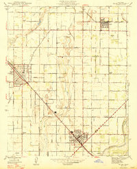
1947 Map of Selma
USGS Topo · Published 1947About this map
The agricultural heart of the San Joaquin Valley is defined here by a dense grid of irrigation ditches and productive orchards at the close of the 1940s. Centered on Selma, this landscape is shaped by the presence of the Southern Pacific and the Atchison Topeka and Santa Fe railroads, which facilitated the region's growth as a major fruit processing and shipping hub. The map captures the social fabric of the era through numerous rural schools like Fruitvale Sch and Clay Sch, alongside the Odd Fellows Cem and Mendocino Cem. Evidence of early aviation appears at Paiva Intercity Landing Field and Selma Landing Field, marking a period of transition in local transportation. Further south, the town of Kingsburg sits near the banks of the Kings River, where the landscape begins to shift toward the Cole Slough and the Fresno and Tulare County line.
Find a feature on this map
71 named features on this map. Tap any name to fly to it.
Don’t see what you’re looking for? This feature index may not catch every label — zoom into the map to look around manually.
Map Details
Editions of this 1947 Selma Map
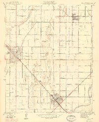
2 editions found
Other maps of this area

1922 · Trimmer
USGS Topo · 1:96,000

1923 · Malaga
USGS Topo · 1:31,680

1923 · Wahtoke
USGS Topo · 1:31,680

1923 · Sanger
USGS Topo · 1:31,680

1924 · Reedley
USGS Topo · 1:31,680

1924 · Selma
USGS Topo · 1:31,680

1924 · Conejo
USGS Topo · 1:31,680

1924 · Dinuba
USGS Topo · 1:125,000

1926 · Burris Park
USGS Topo · 1:31,680

1927 · Traver
USGS Topo · 1:31,680