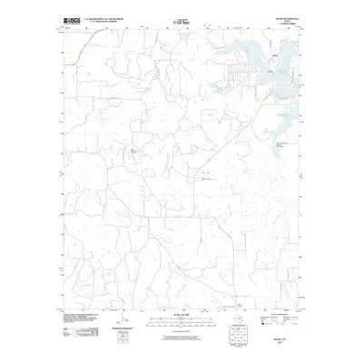
2010 Map of Selma
USGS Topo · Published 2010About this map
The waters of Lake Amon G Carter define the northern landscape of this Texas quadrangle, where the settlement of Selma sits near the shoreline. This area of Montague County is characterized by a dense network of seasonal and perennial waterways, including Big Sandy Creek, Kiel Creek, and Cowskin Creek, which feed into the larger reservoir system. The Soil Conservation Service Site 8 Dam represents mid-century infrastructure designed to manage these prairie watersheds. Industry and local history meet at the Bowie Southwest Oil Field, reflecting the region's reliance on mineral resources. For those tracing family history, both the Selma Cemetery and Crafton Cemetery are documented, alongside a web of rural farm-to-market roads like FM 1125 and FM 2127 that connect these dispersed rural communities.
Find a feature on this map
32 named features on this map. Tap any name to fly to it.
Don’t see what you’re looking for? This feature index may not catch every label — zoom into the map to look around manually.
Map Details
Editions of this 2010 Selma Map
This is the sole edition of this map. No revisions or reprints were ever made.
Other maps of this area

1905 · Montague
USGS Topo · 1:125,000

1954 · Sherman
USGS Topo · 1:250,000

1954 · Wichita Falls
USGS Topo · 1:250,000

1958 · Wichita Falls
USGS Topo · 1:250,000

1958 · Sherman
USGS Topo · 1:250,000

1961 · Brushy Mound
USGS Topo · 1:24,000

1961 · Selma
USGS Topo · 1:24,000

1961 · Sunset
USGS Topo · 1:24,000

1961 · Bowie
USGS Topo · 1:24,000

1961 · Crafton
USGS Topo · 1:24,000