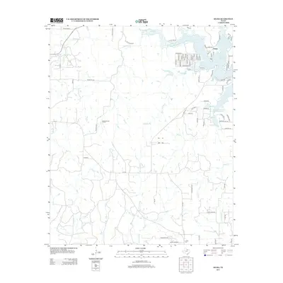
2013 Map of Selma
USGS Topo · Published 2013About this map
Selma sits at the edge of the northwestern reaches of Lake Amon G Carter in Montague County, defined by a landscape of creek drainages and petroleum production. The map illustrates a rural Texas environment where energy extraction and agriculture intersect, notably at the Bowie Southwest Oil Field and various lease roads such as Oilfield Lease Road. Local history is anchored by the Selma Cem and Crafton Cem, while the hydrologic network is dominated by Big Sandy Cr and Cottonwood Cr flowing toward the reservoir. Distinctive local road names like Bugscuffle Rd, Frog Hollard Rd, and Hanging Tree Rd suggest the cultural texture of the region. The map also identifies water management efforts, including the Soil Conservation Service Site 8 Reservoir, which helps regulate the local tributaries feeding into the larger lake system.
Find a feature on this map
89 named features on this map. Tap any name to fly to it.
Don’t see what you’re looking for? This feature index may not catch every label — zoom into the map to look around manually.
Map Details
Editions of this 2013 Selma Map
This is the sole edition of this map. No revisions or reprints were ever made.
Other maps of this area

1905 · Montague
USGS Topo · 1:125,000

1954 · Sherman
USGS Topo · 1:250,000

1954 · Wichita Falls
USGS Topo · 1:250,000

1958 · Wichita Falls
USGS Topo · 1:250,000

1958 · Sherman
USGS Topo · 1:250,000

1961 · Brushy Mound
USGS Topo · 1:24,000

1961 · Selma
USGS Topo · 1:24,000

1961 · Sunset
USGS Topo · 1:24,000

1961 · Bowie
USGS Topo · 1:24,000

1961 · Crafton
USGS Topo · 1:24,000