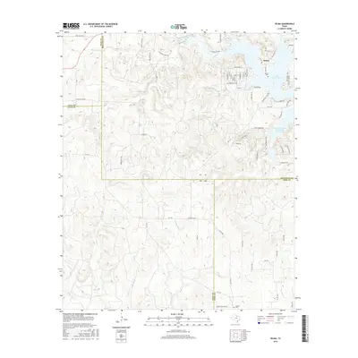
2016 Map of Selma
USGS Topo · Published 2016About this map
Lake Amon G Carter dominates the northeastern corner of this landscape where the boundaries of Montague, Wise, Jack, and Clay counties converge. The settlement of Selma sits near the lakeshore, supported by a network of residential streets such as Northwood St and Frontier Dr, while the Selma Cem preserves the community's local heritage. The terrain is defined by a dense drainage system including Big Sandy Cr, Kiel Cr, and Prairie Br, flowing through the broken country typical of this north Texas region. Evidence of the area's economic history is visible through numerous industrial access routes like Oilfield Lease Rd and Oil Field Rd, which weave between the creeks. Further south, the landscape transitions toward the Wise County line, marked by the Crafton Cem and the Soil Conservation Service Site 8 Reservoir, illustrating mid-century water management efforts.
Find a feature on this map
71 named features on this map. Tap any name to fly to it.
Don’t see what you’re looking for? This feature index may not catch every label — zoom into the map to look around manually.
Map Details
Editions of this 2016 Selma Map
This is the sole edition of this map. No revisions or reprints were ever made.
Other maps of this area

1905 · Montague
USGS Topo · 1:125,000

1954 · Sherman
USGS Topo · 1:250,000

1954 · Wichita Falls
USGS Topo · 1:250,000

1958 · Wichita Falls
USGS Topo · 1:250,000

1958 · Sherman
USGS Topo · 1:250,000

1961 · Brushy Mound
USGS Topo · 1:24,000

1961 · Selma
USGS Topo · 1:24,000

1961 · Sunset
USGS Topo · 1:24,000

1961 · Bowie
USGS Topo · 1:24,000

1961 · Crafton
USGS Topo · 1:24,000