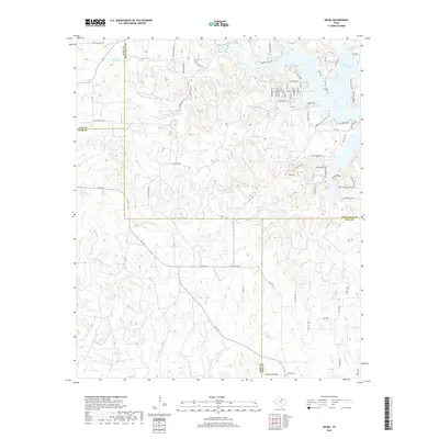
2019 Map of Selma
USGS Topo · Published 2019About this map
Selma sits on the western shores of Lake Amon G Carter in northern Texas, where the terrain is defined by a dense network of seasonal and perennial drainages. This area marks the intersection of four counties, showing the boundaries between Clay, Montague, Jack, and Wise. Residential development near the lake is concentrated along Keys Landing and Northwood Street, while the surrounding landscape remains largely defined by ranching and oil interests, evidenced by routes like Old Oil Field Road and Oilfield Lease Road. Genealogical researchers can locate the Selma Cemetery near the lakeside settlement and Crafton Cemetery at the southern edge of the map. The hydrology is complex, with numerous tributaries including Big Sandy Creek, Kiel Creek, and Cottonwood Creek carving through the low hills.
Find a feature on this map
76 named features on this map. Tap any name to fly to it.
Don’t see what you’re looking for? This feature index may not catch every label — zoom into the map to look around manually.
Map Details
Editions of this 2019 Selma Map
This is the sole edition of this map. No revisions or reprints were ever made.
Other maps of this area

1905 · Montague
USGS Topo · 1:125,000

1954 · Sherman
USGS Topo · 1:250,000

1954 · Wichita Falls
USGS Topo · 1:250,000

1958 · Wichita Falls
USGS Topo · 1:250,000

1958 · Sherman
USGS Topo · 1:250,000

1961 · Brushy Mound
USGS Topo · 1:24,000

1961 · Selma
USGS Topo · 1:24,000

1961 · Sunset
USGS Topo · 1:24,000

1961 · Bowie
USGS Topo · 1:24,000

1961 · Crafton
USGS Topo · 1:24,000