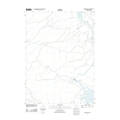
2012 Map of Seminoe Dam
USGS Topo · Published 2012About this map
Seminoe Dam stands as the primary engineering focus of this high-desert landscape, anchoring the northern reach of the Seminoe Reservoir. The topography is defined by the sharp transition between the impounded waters of the N Platte River and the complex drainage network of the surrounding ranchlands. To the north, the waters of the Pathfinder Reservoir just reach into the frame, creating a dual-reservoir environment separated by a network of seasonal drainages with evocative names such as Sunday Morning Cr, Tincup Cr, and Marking Pen Cr. The inclusion of Seminoe State Park and Anderson Ranch highlights the dual nature of the area as both a recreational destination and a working landscape. Primitive routes like Moore Rd and Seminoe Rd provide the only access through this dissected terrain, illustrating the remoteness of Carbon County's water-management infrastructure.
Find a feature on this map
28 named features on this map. Tap any name to fly to it.
Don’t see what you’re looking for? This feature index may not catch every label — zoom into the map to look around manually.
Map Details
Editions of this 2012 Seminoe Dam Map
This is the sole edition of this map. No revisions or reprints were ever made.
Other maps of this area

1953 · Leo
USGS Topo · 1:24,000

1953 · Bradley Peak
USGS Topo · 1:24,000

1953 · Seminoe Dam NE
USGS Topo · 1:24,000

1953 · Seminoe Dam
USGS Topo · 1:24,000

1953 · Wild Horse Mountain
USGS Topo · 1:24,000

1953 · Seminoe Dam SW
USGS Topo · 1:24,000

1953 · Pathfinder Reservoir SW
USGS Topo · 1:24,000

1953 · Buzzard Ranch
USGS Topo · 1:24,000

1953 · Seminoe Dam SE
USGS Topo · 1:24,000

1955 · Casper
USGS Topo · 1:250,000