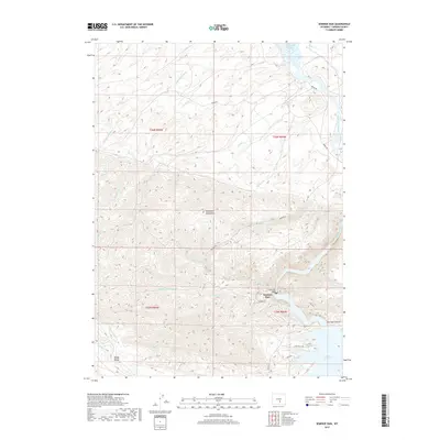
2017 Map of Seminoe Dam
USGS Topo · Published 2017About this map
Seminoe Dam stands as the central engineering landmark of this landscape, anchoring the southern end of a massive hydraulic system where the North Platte River is harnessed for power and irrigation. This 2017 study details the complex geography of the Seminoe Reservoir as it fills the deep contours of Seminoe Canyon, contrasting with the high, arid peaks of the Seminoe Mountains that dominate the central part of the sheet. To the north, the waters of the Pathfinder Reservoir reach into the quadrangle, illustrating the connectivity of the Bureau of Reclamation's projects in the high desert.
Find a feature on this map
30 named features on this map. Tap any name to fly to it.
Don’t see what you’re looking for? This feature index may not catch every label — zoom into the map to look around manually.
Map Details
Editions of this 2017 Seminoe Dam Map
This is the sole edition of this map. No revisions or reprints were ever made.
Other maps of this area

1953 · Leo
USGS Topo · 1:24,000

1953 · Bradley Peak
USGS Topo · 1:24,000

1953 · Seminoe Dam NE
USGS Topo · 1:24,000

1953 · Seminoe Dam
USGS Topo · 1:24,000

1953 · Wild Horse Mountain
USGS Topo · 1:24,000

1953 · Seminoe Dam SW
USGS Topo · 1:24,000

1953 · Pathfinder Reservoir SW
USGS Topo · 1:24,000

1953 · Buzzard Ranch
USGS Topo · 1:24,000

1953 · Seminoe Dam SE
USGS Topo · 1:24,000

1955 · Casper
USGS Topo · 1:250,000