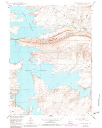
1953 Map of Seminoe Dam SE
USGS Topo · Published 1983About this map
Seminoe Reservoir dominates this landscape, reflecting a mid-century period when water management transformed the high plains of Carbon County. The intricate shoreline of the reservoir, with a spillway elevation of 6358 feet, surrounds the rugged finger-like peninsulas of Seminoe State Park. To the north and east, the transition from water to ranching land is marked by established family operations including McNees Ranch and Tennant Ranch, situated near the drainages of Beaver Creek and McNees Creek. The presence of a Landing Strip near the northern shore suggests the remote nature of these ranching outposts in the early 1950s. The dramatic uplift of Horseshoe Ridge serves as a prominent geologic spine, bisecting the quadrangle and directing seasonal runoff into the massive reservoir below.
Find a feature on this map
17 named features on this map. Tap any name to fly to it.
Don’t see what you’re looking for? This feature index may not catch every label — zoom into the map to look around manually.
Map Details
Editions of this 1953 Seminoe Dam SE Map
3 editions found
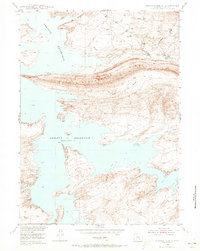
Other maps of this area

1893 · Fort Steele
USGS Topo · 1:125,000

1914 · Hanna
USGS Topo · 1:62,500

1914 · Walcott
USGS Topo · 1:62,500

1953 · Seminoe Dam NE
USGS Topo · 1:24,000

1953 · Seminoe Dam
USGS Topo · 1:24,000

1953 · Seminoe Dam SW
USGS Topo · 1:24,000

1953 · Seminoe Dam SE
USGS Topo · 1:24,000

1953 · Schneider Ridge
USGS Topo · 1:24,000

1953 · Beaver Creek
USGS Topo · 1:24,000

1954 · Rawlins
USGS Topo · 1:250,000