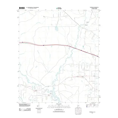
2011 Map of Seminole
USGS Topo · Published 2011About this map
The Perdido River and its intricate network of tributaries define this borderland between Alabama and Florida as it appeared in the early 21st century. Near the southern edge of the map, the settlement of Seminole serves as a local hub where the Styx River joins the larger drainage system. The landscape is marked by a legacy of family and community identity, evidenced by several small burial grounds including the Allen Cemetery in the north and the Mitchell Cemetery near the river bends.
Find a feature on this map
58 named features on this map. Tap any name to fly to it.
Don’t see what you’re looking for? This feature index may not catch every label — zoom into the map to look around manually.
Map Details
Editions of this 2011 Seminole Map
This is the sole edition of this map. No revisions or reprints were ever made.
Other maps of this area

1920 · Robertsdale
USGS Topo · 1:62,500

1921 · Bon Secour
USGS Topo · 1:62,500

1921 · Fort Barrancas
USGS Topo · 1:62,500

1921 · Muscogee
USGS Topo · 1:62,500

1941 · Fort Barrancas
USGS Topo · 1:62,500

1941 · Muscogee
USGS Topo · 1:62,500

1941 · Robertsdale
USGS Topo · 1:62,500

1941 · Foley
USGS Topo · 1:62,500

1943 · Robertsdale
USGS Topo · 1:62,500

1943 · Muscogee
USGS Topo · 1:62,500