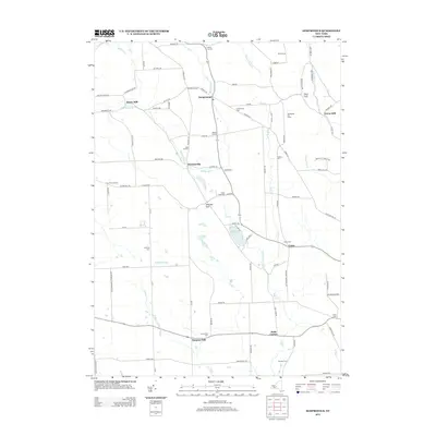
2013 Map of Sempronius
USGS Topo · Published 2013About this map
Sempronius and its surrounding hamlets are defined by the deep glacial incisions of the Finger Lakes region, particularly the distinct ravines of Scott Gulf and Sherman Gulf. Early industry here relied on the steady descent of local waterways, as evidenced by Morse Mill along Dresserville Cr and Grout Mill situated to the northeast. This 2013 survey illustrates a landscape primarily shaped by rural dairy farming and small crossroads settlements, including Dresserville and Como. For genealogists, the map provides precise locations for numerous family and community burial grounds, such as Lickville Cem and Wilcox Cem, many of which sit atop the high ridges. The hydrology of the area is centralized around Lake Como, which feeds the Lake Como Outlet and Fall Cr, while the northern portion is dominated by the complex drainage patterns of Mill Brook and Bear Swamp Cr.
Find a feature on this map
96 named features on this map. Tap any name to fly to it.
Don’t see what you’re looking for? This feature index may not catch every label — zoom into the map to look around manually.
Map Details
Editions of this 2013 Sempronius Map
This is the sole edition of this map. No revisions or reprints were ever made.
Other maps of this area

1898 · Moravia
USGS Topo · 1:62,500

1899 · Skaneateles
USGS Topo · 1:62,500

1900 · Tully
USGS Topo · 1:62,500

1902 · Skaneateles
USGS Topo · 1:62,500

1902 · Moravia
USGS Topo · 1:62,500

1903 · Cortland
USGS Topo · 1:62,500

1942 · Groton
USGS Topo · 1:24,000

1943 · Moravia
USGS Topo · 1:31,680

1943 · West Groton
USGS Topo · 1:31,680

1943 · Spafford
USGS Topo · 1:31,680