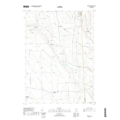
2019 Map of Sempronius
USGS Topo · Published 2019About this map
Lake Como and its surrounding wetlands form a central hub for the small communities and rural roads along the border of Cayuga and Cortland Counties. The landscape is defined by its deep north-south valleys and glaciated terrain, specifically the distinctive Homer Gulf and Kinney Gulf that carve through the southern uplands. Historic milling sites such as Morse Mill and Grout Mill indicate a legacy of water-powered industry along Mill Brook and Grout Brook, while small rural centers like Dresserville and Sempronius maintain their traditional footprints amidst a network of family-named roads. Genealogists will find a high concentration of burial grounds throughout the countryside, ranging from the Lickville Cem in the west to the Hinman Cem near the southern border. The transition from the Bear Swamp Cr headwaters to the south-flowing Fall Cr system illustrates the intricate drainage patterns of this high-elevation agricultural region.
Find a feature on this map
101 named features on this map. Tap any name to fly to it.
Don’t see what you’re looking for? This feature index may not catch every label — zoom into the map to look around manually.
Map Details
Editions of this 2019 Sempronius Map
This is the sole edition of this map. No revisions or reprints were ever made.
Other maps of this area

1898 · Moravia
USGS Topo · 1:62,500

1899 · Skaneateles
USGS Topo · 1:62,500

1900 · Tully
USGS Topo · 1:62,500

1902 · Skaneateles
USGS Topo · 1:62,500

1902 · Moravia
USGS Topo · 1:62,500

1903 · Cortland
USGS Topo · 1:62,500

1942 · Groton
USGS Topo · 1:24,000

1943 · Moravia
USGS Topo · 1:31,680

1943 · West Groton
USGS Topo · 1:31,680

1943 · Spafford
USGS Topo · 1:31,680