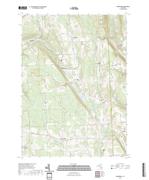
2023 Map of Sempronius
USGS Topo · Published 2023About this map
The glacial terrain of Cayuga County and Cortland County defines this landscape of steep-walled gulfs and upland plateaus. The settlement of Dresserville sits nestled along Dresserville Creek, a corridor that also supports the milling history of Morse Mill. In the south, Summer Hill and Chipman Corners anchor a rural road network that follows the high ridges between drainage basins. Deep ravines such as Sherman Gulf, Scott Gulf, and Vrooman Gulf cut through the topography, illustrating the dramatic elevation shifts characteristic of the Finger Lakes region's eastern edges.
Find a feature on this map
106 named features on this map. Tap any name to fly to it.
Don’t see what you’re looking for? This feature index may not catch every label — zoom into the map to look around manually.
Map Details
Editions of this 2023 Sempronius Map
This is the sole edition of this map. No revisions or reprints were ever made.
Other maps of this area

1898 · Moravia
USGS Topo · 1:62,500

1899 · Skaneateles
USGS Topo · 1:62,500

1900 · Tully
USGS Topo · 1:62,500

1902 · Skaneateles
USGS Topo · 1:62,500

1902 · Moravia
USGS Topo · 1:62,500

1903 · Cortland
USGS Topo · 1:62,500

1942 · Groton
USGS Topo · 1:24,000

1943 · Moravia
USGS Topo · 1:31,680

1943 · West Groton
USGS Topo · 1:31,680

1943 · Spafford
USGS Topo · 1:31,680