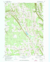
1971 Map of Sempronius
USGS Topo · Published 1974About this map
Bear Swamp State Forest and Summer Hill State Forest dominate the high ground of the Cayuga and Cortland county lines in this 1971 survey. The landscape is defined by deep glacial gouges like Scott Gulf and Sherman Gulf, which steer the local road network around steep inclines. Small agricultural hamlets and named intersections such as Dresserville, Sempronius, and Wards Corners remain the primary hubs of activity, linked by an intricate web of rural routes like Dresserville Road and Salt Road. Local industry and community life are grounded in landmarks like Morse Mill and Grout Mill, alongside rural anchors like Summer Hill Ch and the Lickville Cem. The presence of Lake Como and its outlet provides a natural focal point amidst the forested ridges and scattered farmsteads of the central Finger Lakes region.
Find a feature on this map
82 named features on this map. Tap any name to fly to it.
Don’t see what you’re looking for? This feature index may not catch every label — zoom into the map to look around manually.
Map Details
Editions of this 1971 Sempronius Map
This is the sole edition of this map. No revisions or reprints were ever made.
Other maps of this area

1898 · Moravia
USGS Topo · 1:62,500

1899 · Skaneateles
USGS Topo · 1:62,500

1900 · Tully
USGS Topo · 1:62,500

1902 · Skaneateles
USGS Topo · 1:62,500

1902 · Moravia
USGS Topo · 1:62,500

1903 · Cortland
USGS Topo · 1:62,500

1942 · Groton
USGS Topo · 1:24,000

1943 · Moravia
USGS Topo · 1:31,680

1943 · West Groton
USGS Topo · 1:31,680

1943 · Spafford
USGS Topo · 1:31,680