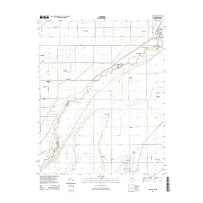
2015 Map of Senath
USGS Topo · Published 2015About this map
The Saint Francis River serves as the prominent natural boundary between Arkansas and Missouri in this Bootheel region study. The landscape is defined by an intricate network of drainage and former river paths, including the Old Channel Varney River, Kinnemore Slough, and the Varney River Canal. These waterways underscore the history of land reclamation and agriculture that transformed this alluvial plain. The town of Senath stands as the primary hub, surrounded by family-named landmarks and historical infrastructure. Industrial sites like Mitchell Mill and Johnson Mill are located near the rural communities of White Oak and Austin. For those tracing family histories, several burial grounds are scattered across the region, from the centrally located Senath Cemetery and Lanier Cemetery to the more outlying McGrew Cemetery and Leonard Cemetery.
Find a feature on this map
83 named features on this map. Tap any name to fly to it.
Don’t see what you’re looking for? This feature index may not catch every label — zoom into the map to look around manually.
Map Details
Editions of this 2015 Senath Map
This is the sole edition of this map. No revisions or reprints were ever made.
Other maps of this area

1934 · Kennett
USGS Topo · 1:62,500

1935 · Rector
USGS Topo · 1:62,500

1940 · Marmaduke
USGS Topo · 1:62,500

1940 · Kennett
USGS Topo · 1:62,500

1940 · Piggott
USGS Topo · 1:62,500

1956 · Kennett
USGS Topo · 1:62,500

1956 · Piggott
USGS Topo · 1:62,500

1957 · Poplar Bluff
USGS Topo · 1:250,000

1958 · Marmaduke
USGS Topo · 1:62,500

1958 · Rector
USGS Topo · 1:62,500