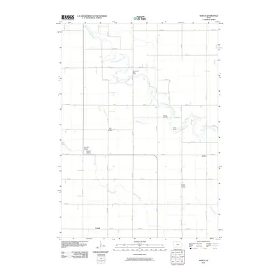
2010 Map of Seneca
USGS Topo · Published 2010About this map
The East Fork Des Moines River defines the north and eastern reaches of this rural landscape, winding through a grid of country roads and agricultural plots. The small settlement of Seneca sits along the eastern edge, while Forsyth is positioned further south, reflecting the dispersed nature of this prairie community. The map is a valuable resource for local genealogy, noting several community landmarks including the Seneca Township Cemetery, Saint Pauls Cemetery, and the Ringsted Memorial Cemetery located near Saint Johns Lutheran Cemetery.
Find a feature on this map
42 named features on this map. Tap any name to fly to it.
Don’t see what you’re looking for? This feature index may not catch every label — zoom into the map to look around manually.
Map Details
Editions of this 2010 Seneca Map
This is the sole edition of this map. No revisions or reprints were ever made.
Other maps of this area

1954 · Fairmont
USGS Topo · 1:250,000

1958 · Fairmont
USGS Topo · 1:250,000

1980 · Lone Rock
USGS Topo · 1:24,000

1980 · Fenton
USGS Topo · 1:24,000

1980 · Depew
USGS Topo · 1:24,000

1980 · Seneca
USGS Topo · 1:24,000

1980 · Armstrong
USGS Topo · 1:24,000

1980 · Ringsted
USGS Topo · 1:24,000

1980 · Swea City
USGS Topo · 1:24,000

1980 · Armstrong SE
USGS Topo · 1:24,000