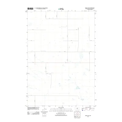
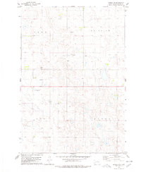
2012 Map of Seneca SW
USGS Topo · Published 2012About this map
Glacial potholes and prairie wetlands define this rural landscape in Potter County during the early 21st century. The terrain is structured by a rigorous section-line road grid, including 321st Ave and 324th Ave, which navigate around numerous unnamed seasonal ponds and basins. This mapping shows the persistent agricultural layout of the Great Plains, where long-established range lines like 157 St and 164 St serve as the primary infrastructure for the sparsely populated region. The lack of concentrated settlements or named towns highlights the area's character as a pure agricultural and grazing territory, where the physical geography of the water-table and prairie depressional wetlands dictates the placement of travel routes like 322nd Ave.
Find a feature on this map
13 named features on this map. Tap any name to fly to it.
Don’t see what you’re looking for? This feature index may not catch every label — zoom into the map to look around manually.
Map Details
Editions of this 2012 Seneca SW Map
This is the sole edition of this map. No revisions or reprints were ever made.
Other maps of this area

1953 · Huron
USGS Topo · 1:250,000

1954 · Aberdeen
USGS Topo · 1:250,000

1954 · Huron
USGS Topo · 1:250,000

1956 · Aberdeen
USGS Topo · 1:250,000

1974 · Hoven
USGS Topo · 1:24,000
1974 · Gettysburg Muni. Airport NE
USGS Topo · 1:24,000
1978 · Bald Hills
USGS Topo · 1:24,000
1978 · Tolstoy
USGS Topo · 1:24,000

1978 · Seneca NW
USGS Topo · 1:24,000
1978 · Seneca SW
USGS Topo · 1:24,000