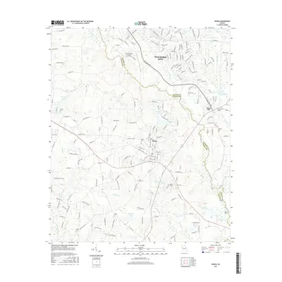
2017 Map of Senoia
USGS Topo · Published 2017About this map
Senoia and the southern edge of Peachtree City anchor this 2017 survey of the borderlands between Fayette and Coweta counties. The landscape is characterized by its numerous water bodies and small private airstrips, including Atlanta Regional Airport Falcon Field and Kenley Field. Significant genealogical sites are scattered throughout the region, from the Senoia City Cem and Oak Grove Cem in the town center to the outlying Neriah Cem and Tranquil Cem.
Find a feature on this map
193 named features on this map. Tap any name to fly to it.
Don’t see what you’re looking for? This feature index may not catch every label — zoom into the map to look around manually.
Map Details
Editions of this 2017 Senoia Map
This is the sole edition of this map. No revisions or reprints were ever made.
Other maps of this area

1953 · Atlanta
USGS Topo · 1:250,000

1957 · Atlanta
USGS Topo · 1:250,000

1958 · Atlanta
USGS Topo · 1:250,000

1965 · Tyrone
USGS Topo · 1:24,000

1965 · Fayetteville
USGS Topo · 1:24,000

1965 · Madras
USGS Topo · 1:24,000

1965 · Senoia
USGS Topo · 1:24,000

1965 · Brooks
USGS Topo · 1:24,000

1965 · Sharpsburg
USGS Topo · 1:24,000
1971 · Luthersville
USGS Topo · 1:24,000