
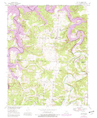
1949 Map of Sentinel
USGS Topo · Published 1973About this map
The Pomme de Terre River carves a deep, winding path through this corner of Hickory and Polk Counties, creating distinctive landmarks like the Dooley Bend and the Nigger Bend Bluff. The landscape is defined by the transition from river bottomlands to higher ridges, where small crossroads communities and rural institutions formed the backbone of local life in the late 1940s. Many of these points, such as Adonis and Mohawk Corner, represent the dispersed settlement pattern typical of the Missouri Ozarks before major infrastructure changes.
Find a feature on this map
37 named features on this map. Tap any name to fly to it.
Don’t see what you’re looking for? This feature index may not catch every label — zoom into the map to look around manually.
Map Details
Editions of this 1949 Sentinel Map
2 editions found
Other maps of this area

1884 · Bolivar
USGS Topo · 1:125,000

1892 · Bolivar
USGS Topo · 1:125,000

1942 · Elkton
USGS Topo · 1:24,000

1949 · Elkton
USGS Topo · 1:24,000

1950 · Elkton
USGS Topo · 1:24,000

1950 · Sentinel
USGS Topo · 1:24,000

1950 · Buffalo NW
USGS Topo · 1:24,000

1950 · Polk
USGS Topo · 1:24,000

1950 · Urbana
USGS Topo · 1:24,000

1950 · Cliquot
USGS Topo · 1:24,000