
1949 Map of Sentinel
USGS Topo · Published 1961About this map
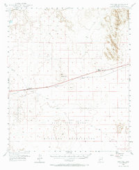
The Gila River cuts through the northern corner of this arid landscape, characterized by the rising peaks of the Painted Rock Mountains and the distinct volcanic form of Sentinel Pk. The mid-century transportation corridor follows a tight east-west axis, where the Southern Pacific railroad and a 4 Lane roadway link the sparse desert outposts of Sentinel, Tartron, and Midway Station.
Find a feature on this map
14 named features on this map. Tap any name to fly to it.
Don’t see what you’re looking for? This feature index may not catch every label — zoom into the map to look around manually.
Map Details
Editions of this 1949 Sentinel Map
2 editions found
Other maps of this area

1927 · Aguila Mountains
USGS Topo · 1:48,000

1927 · Hyder
USGS Topo · 1:62,500

1929 · Aztec
USGS Topo · 1:62,500

1930 · Aguila Mountains
USGS Topo · 1:62,500

1930 · Hyder
USGS Topo · 1:62,500

1942 · Vicksburg
USGS Topo · 1:250,000

1950 · Sentinel
USGS Topo · 1:62,500

1950 · Theba
USGS Topo · 1:62,500

1950 · Aztec
USGS Topo · 1:62,500

1951 · Theba
USGS Topo · 1:62,500