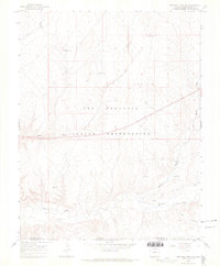
1966 Map of Sentinel Peak SE
USGS Topo · Published 1969About this map
The Ute Mountain Indian Reservation defines the character of this southwestern Colorado landscape, where the high desert is carved by seasonal drainage systems. The presence of Indian Ruins near the Mancos River suggests a deep history of habitation and land use long before the mid-century industrial interests arrived. The terrain is marked by the winding courses of Aztec Wash, Cowboy Wash, and Navajo Wash, which converge toward the river valley in the south.
Find a feature on this map
15 named features on this map. Tap any name to fly to it.
Don’t see what you’re looking for? This feature index may not catch every label — zoom into the map to look around manually.
Map Details
Editions of this 1966 Sentinel Peak SE Map
2 editions found
Other maps of this area

1889 · Chaco
USGS Topo · 1:250,000

1892 · Chaco
USGS Topo · 1:250,000

1934 · Chimney Rock
USGS Topo · 1:62,500

1934 · Rattlesnake
USGS Topo · 1:62,500

1936 · Chimney Rock
USGS Topo · 1:62,500

1937 · Rattlesnake
USGS Topo · 1:62,500

1954 · Shiprock
USGS Topo · 1:250,000

1956 · Cortez
USGS Topo · 1:250,000

1958 · Sentinel Peak NW
USGS Topo · 1:24,000

1958 · Sentinel Peak NE
USGS Topo · 1:24,000