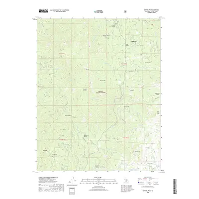
2018 Map of Sentinel Peak
USGS Topo · Published 2018About this map
The settlement of Ponderosa serves as a small hub in this high-altitude landscape of the Sequoia National Forest. The 2018 survey reveals a network of meadows and peaks that define the geography of Tulare County, centered around the S Fork Middle Fork Tule River and S Fork Tule River. Named features like Quaking Aspen Meadow, Quaker Meadow, and Holby Meadow indicate the historical importance of these open spaces within the timbered terrain. Prominent summits including Slate Mtn, Mule Peak, and Sentinel Peak overlook a complex system of Forest Service routes, such as Forest Rte 21S05 and Forest Rte 21S72. The map details the headwaters of numerous creeks, including Nobe Young Cr and Peppermint Cr, which carve through features like Horse Canyon and Windy Gap.
Find a feature on this map
60 named features on this map. Tap any name to fly to it.
Don’t see what you’re looking for? This feature index may not catch every label — zoom into the map to look around manually.
Map Details
Editions of this 2018 Sentinel Peak Map
This is the sole edition of this map. No revisions or reprints were ever made.
Other maps of this area

1904 · Kaweah
USGS Topo · 1:125,000

1905 · Olancha
USGS Topo · 1:125,000

1905 · Fairview
USGS Topo · 1:24,000

1906 · Kernville
USGS Topo · 1:125,000

1907 · Olancha
USGS Topo · 1:125,000

1908 · Kernville
USGS Topo · 1:125,000

1909 · Kaweah
USGS Topo · 1:125,000

1918 · Fairview
USGS Topo · 1:31,680

1936 · Tobias Peak
USGS Topo · 1:125,000

1937 · Kaweah
USGS Topo · 1:125,000