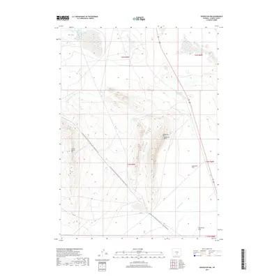
2017 Map of Separation Rim
USGS Topo · Published 2017About this map
Separation Rim Separation Point rises as a prominent landmark in this high-desert landscape, anchored by the Continental Divide National Scenic Trail as it snakes across the basin. The area is defined by its seasonal hydrology and geological formations, including Coyote Springs Rim and the wide expanse of Separation Flats. Scattered across the northern half are several ephemeral water bodies such as Mahoney Lake, Bull Spring Lake, and Soda Lake, which illustrate the drainage patterns typical of this portion of Carbon County. Along the eastern edge, US Route 287 provides the primary transit corridor, passing near Separation Point Lake and the headwaters of Separation Creek. This terrain reflects the remote, open character of Wyoming's central basins, where navigation historically relied on distinct rim formations and the rare presence of reliable draws like Cold Spring Draw.
Find a feature on this map
18 named features on this map. Tap any name to fly to it.
Don’t see what you’re looking for? This feature index may not catch every label — zoom into the map to look around manually.
Map Details
Editions of this 2017 Separation Rim Map
This is the sole edition of this map. No revisions or reprints were ever made.
Other maps of this area

1954 · Rawlins
USGS Topo · 1:250,000

1955 · Casper
USGS Topo · 1:250,000

1956 · Rawlins Peak
USGS Topo · 1:62,500

1958 · Rawlins
USGS Topo · 1:250,000

1958 · Casper
USGS Topo · 1:250,000

1960 · Separation Rim
USGS Topo · 1:24,000

1960 · Bull Springs
USGS Topo · 1:24,000

1960 · Buck Draw
USGS Topo · 1:24,000

1960 · Boggy Meadows
USGS Topo · 1:24,000

1961 · Lamont NE
USGS Topo · 1:24,000