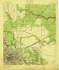
1922 Map of Settegast
USGS Topo · Published 1922About this map
Houston expands northward and eastward in this topographic survey, revealing the industrial and residential grid as it moved toward the ship channel. Early neighborhoods like Denver, the Brooke-Smith Addition, and the Fidelity Addition are clearly defined, showing the city's early 20th-century morphology. The landscape is heavily influenced by a dense network of rail lines, including the International and Great Northern and the Houston East and West Texas, which facilitated the movement of goods through Houston Harbor.
Find a feature on this map
30 named features on this map. Tap any name to fly to it.
Don’t see what you’re looking for? This feature index may not catch every label — zoom into the map to look around manually.
Map Details
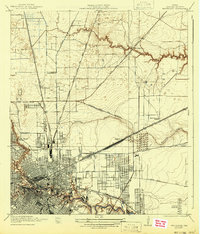
Editions of this 1922 Settegast Map
2 editions found
Other maps of this area

1915 · Bellaire
USGS Topo · 1:24,000

1915 · Park Place
USGS Topo · 1:24,000

1915 · Houston Heights
USGS Topo · 1:24,000

1915 · Deepwater
USGS Topo · 1:24,000

1916 · Aldine
USGS Topo · 1:24,000

1916 · Settegast
USGS Topo · 1:24,000

1916 · Fauna
USGS Topo · 1:24,000

1916 · Harmaston
USGS Topo · 1:24,000

1916 · Humble
USGS Topo · 1:24,000

1919 · Aldine
USGS Topo · 1:31,680