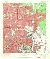
1967 Map of Settegast
USGS Topo · Published 1970About this map
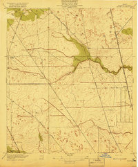
Houston's northeastern industrial and residential expansion is evident in this late-1960s survey, dominated by a dense network of railroads and shipping infrastructure. The Settegast area serves as a focal point for the region's transportation economy, featuring the massive Settegast Yards and the convergence of the Missouri Pacific and Southern Pacific lines. These transit corridors are flanked by established neighborhoods like Sherwood Place, North Shadydale, and Hawthorne Place, many of which developed alongside the local school system including Patrick Henry Jr High Sch and Smiley High Sch.
Find a feature on this map
98 named features on this map. Tap any name to fly to it.
Don’t see what you’re looking for? This feature index may not catch every label — zoom into the map to look around manually.
Map Details
Editions of this 1967 Settegast Map
2 editions found

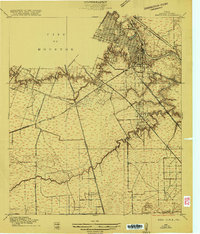
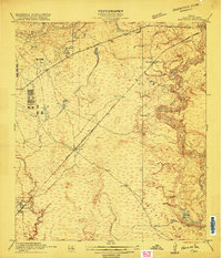
Other maps of this area
1915 · Bellaire
USGS Topo · 1:24,000
1915 · Park Place
USGS Topo · 1:24,000

1915 · Houston Heights
USGS Topo · 1:24,000

1915 · Deepwater
USGS Topo · 1:24,000

1916 · Aldine
USGS Topo · 1:24,000

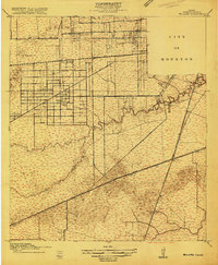
1916 · Settegast
USGS Topo · 1:24,000

1916 · Fauna
USGS Topo · 1:24,000
1916 · Harmaston
USGS Topo · 1:24,000

1916 · Humble
USGS Topo · 1:24,000
1919 · Aldine
USGS Topo · 1:31,680