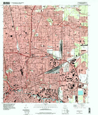
1995 Map of Settegast
USGS Topo · Published 1999About this map
Settegast Yards dominates the central landscape of this eastern Houston survey, reflecting the intensive industrial and transit infrastructure of the mid-1990s. The map captures a complex urban corridor where Halls Bayou and Hunting Bayou weave through densely packed neighborhoods and industrial zones. To the south, the Turning Basin and Buffalo Bayou anchor the region's shipping economy, while the presence of Hollywood Cemetery, Oak Park Cemetery, and Holy Cross Cem provides significant reference points for local genealogists. Numerous educational institutions, such as Kashmere Gardens High Sch and Forest Brook High Sch, illustrate the established community structure of Settegast and East Houston before the turn of the century. This era of Houston's development is marked by the clear Corporate Boundary lines and a vast network of arterial roads like Liberty Road.
Find a feature on this map
46 named features on this map. Tap any name to fly to it.
Don’t see what you’re looking for? This feature index may not catch every label — zoom into the map to look around manually.
Map Details
Editions of this 1995 Settegast Map
This is the sole edition of this map. No revisions or reprints were ever made.
Other maps of this area

1915 · Bellaire
USGS Topo · 1:24,000

1915 · Park Place
USGS Topo · 1:24,000

1915 · Houston Heights
USGS Topo · 1:24,000

1915 · Deepwater
USGS Topo · 1:24,000

1916 · Aldine
USGS Topo · 1:24,000

1916 · Settegast
USGS Topo · 1:24,000

1916 · Fauna
USGS Topo · 1:24,000

1916 · Harmaston
USGS Topo · 1:24,000

1916 · Humble
USGS Topo · 1:24,000

1919 · Aldine
USGS Topo · 1:31,680