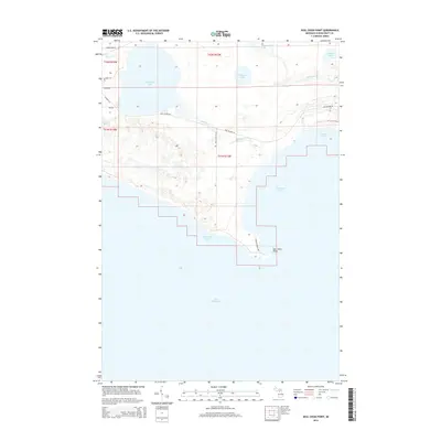
2014 Map of Seul Choix Point
USGS Topo · Published 2014About this map
Seul Choix Point juts into the cold waters of Lake Michigan, anchoring a coastline defined by industrial maritime activity and complex hydrology. This 2014 survey captures the significant development of Inland Harbor, where Port Inland Rd connects the shoreline to the inland infrastructure. The landscape is a mosaic of water bodies, from the expansive McDonald Lake and Shuberts Lake to the meandering Milakokia River, which flows through Stone Rapids toward the east.
Find a feature on this map
26 named features on this map. Tap any name to fly to it.
Don’t see what you’re looking for? This feature index may not catch every label — zoom into the map to look around manually.
Map Details
Editions of this 2014 Seul Choix Point Map
This is the sole edition of this map. No revisions or reprints were ever made.
Other maps of this area

1931 · Seul Choix Point NE
USGS Topo · 1:31,680

1931 · Seul Choix Point NW
USGS Topo · 1:31,680

1931 · Manistique River SE
USGS Topo · 1:31,680

1931 · Blaney SW
USGS Topo · 1:31,680

1931 · Blaney SE
USGS Topo · 1:31,680

1954 · Escanaba
USGS Topo · 1:250,000

1954 · Sault Sainte Marie
USGS Topo · 1:250,000

1955 · Cheboygan
USGS Topo · 1:250,000

1956 · Sault Sainte Marie
USGS Topo · 1:250,000

1957 · Escanaba
USGS Topo · 1:250,000