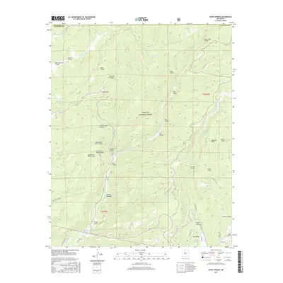
2017 Map of Seven Springs
USGS Topo · Published 2017About this map
Santa Fe National Forest encompasses the vast majority of this landscape, characterized by a complex network of canyons and high-elevation water sources. The settlement of Seven Springs serves as a focal point along the Rio Cebolla, while further south, the community of La Cueva sits near the junction of San Antonio Cr and several forest access roads. The map captures a high-country environment where geothermal and hydrological features are prominent, including the San Antonio Hot Spring and the southern reach of Fenton Lake.
Find a feature on this map
52 named features on this map. Tap any name to fly to it.
Don’t see what you’re looking for? This feature index may not catch every label — zoom into the map to look around manually.
Map Details
Editions of this 2017 Seven Springs Map
This is the sole edition of this map. No revisions or reprints were ever made.
Other maps of this area

1890 · Jemes
USGS Topo · 1:125,000

1892 · Jemes
USGS Topo · 1:125,000

1909 · Gallina
USGS Topo · 1:125,000

1937 · Jemez Springs
USGS Topo · 1:48,000

1939 · La Ventana
USGS Topo · 1:62,500

1940 · Cuba
USGS Topo · 1:62,500

1943 · Cuba
USGS Topo · 1:62,500

1943 · La Ventana
USGS Topo · 1:62,500

1944 · Jemez Springs
USGS Topo · 1:62,500

1952 · Jemez Springs
USGS Topo · 1:62,500