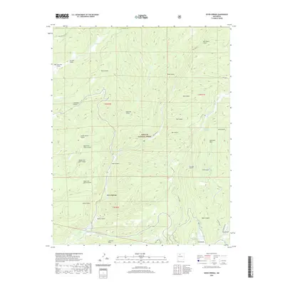
2020 Map of Seven Springs
USGS Topo · Published 2020About this map
Rio Cebolla and San Antonio Cr carve deep drainage patterns through this high-altitude section of the Santa Fe National Forest in northern New Mexico. The map centers on the small community of Seven Springs, an area defined by its complex network of named canyons including School Section Canyon, Bear Canyon, and Spring Canyon. To the south, the settlement of La Cueva sits near the confluence of local waterways and the northern tip of Fenton Lake. The topography is marked by distinct geological features such as the volcanic Lake Fork Mesa and the curious Mushroom Basin. This 2020 survey details a landscape where recreation and natural resources intersect, showing the remote San Antonio Hot Spring and specialized terrain like Ice Cave Canyon tucked away from the main route of 31 Mile Road.
Find a feature on this map
42 named features on this map. Tap any name to fly to it.
Don’t see what you’re looking for? This feature index may not catch every label — zoom into the map to look around manually.
Map Details
Editions of this 2020 Seven Springs Map
This is the sole edition of this map. No revisions or reprints were ever made.
Other maps of this area

1890 · Jemes
USGS Topo · 1:125,000

1892 · Jemes
USGS Topo · 1:125,000

1909 · Gallina
USGS Topo · 1:125,000

1937 · Jemez Springs
USGS Topo · 1:48,000

1939 · La Ventana
USGS Topo · 1:62,500

1940 · Cuba
USGS Topo · 1:62,500

1943 · Cuba
USGS Topo · 1:62,500

1943 · La Ventana
USGS Topo · 1:62,500

1944 · Jemez Springs
USGS Topo · 1:62,500

1952 · Jemez Springs
USGS Topo · 1:62,500