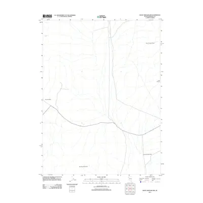
2011 Map of Seven Troughs NW
USGS Topo · Published 2011About this map
Heineke Spring serves as a vital water point in this arid stretch of Pershing County, situated at the base of the Seven Troughs Range. This 2011 survey captures the vast basins and ranges of the Great Basin, where the Kumiva Valley and Granite Springs Valley dominate the lowlands between stark uplifted formations. The southern portion of the map is anchored by the Blue Wing Mountains, while the eastern flank is defined by the steep descent of Long Canyon. This landscape reflects the quintessential geography of northwestern Nevada, characterized by deep alluvial valleys separated by isolated mountain blocks, with very few reliable water sources like the spring noted in the northwest corner. A single primary roadway traverses the valleys, connecting these remote topographic features in a region defined more by its geological character than its modern infrastructure.
Find a feature on this map
6 named features on this map. Tap any name to fly to it.
Don’t see what you’re looking for? This feature index may not catch every label — zoom into the map to look around manually.
Map Details
Editions of this 2011 Seven Troughs NW Map
This is the sole edition of this map. No revisions or reprints were ever made.
Other maps of this area

1886 · Granite Range
USGS Topo · 1:250,000

1894 · Granite Range
USGS Topo · 1:250,000

1931 · Lovelock
USGS Topo · 1:250,000

1935 · Lovelock
USGS Topo · 1:250,000

1955 · Lovelock
USGS Topo · 1:250,000

1959 · Lovelock
USGS Topo · 1:250,000

1980 · Eagle Rock Spring
USGS Topo · 1:24,000

1981 · Twin Buttes Well
USGS Topo · 1:24,000

1981 · Gerlach
USGS Topo · 1:100,000

1981 · Bluewing Flat North
USGS Topo · 1:24,000