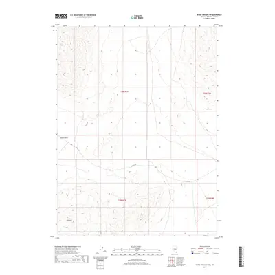
2018 Map of Seven Troughs NW
USGS Topo · Published 2018About this map
The Blue Wing Mountains dominate the southwestern portion of this Pershing County landscape, where the terrain transitions sharply toward the Kumiva Valley to the west. This 2018 survey reveals a territory primarily defined by its physical geography and basic transportation corridors rather than dense settlement. The presence of Heineke Spring in the northwestern corner highlights the importance of isolated water sources in this arid Basin and Range environment. Modern infrastructure is represented by the path of State Hwy 399, which cuts across the central part of the quadrangle, providing the primary access through these high-desert canyons and basins. The land is organized under the Public Land Survey System, with township and range lines like t30n r27e and t30n r28e carving the vast open spaces into a grid for management and mineral exploration.
Find a feature on this map
9 named features on this map. Tap any name to fly to it.
Don’t see what you’re looking for? This feature index may not catch every label — zoom into the map to look around manually.
Map Details
Editions of this 2018 Seven Troughs NW Map
This is the sole edition of this map. No revisions or reprints were ever made.
Other maps of this area

1886 · Granite Range
USGS Topo · 1:250,000

1894 · Granite Range
USGS Topo · 1:250,000

1931 · Lovelock
USGS Topo · 1:250,000

1935 · Lovelock
USGS Topo · 1:250,000

1955 · Lovelock
USGS Topo · 1:250,000

1959 · Lovelock
USGS Topo · 1:250,000

1980 · Eagle Rock Spring
USGS Topo · 1:24,000

1981 · Twin Buttes Well
USGS Topo · 1:24,000

1981 · Gerlach
USGS Topo · 1:100,000

1981 · Bluewing Flat North
USGS Topo · 1:24,000