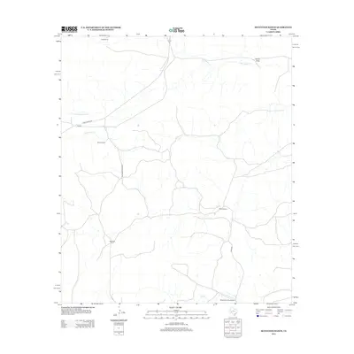
2012 Map of Seventeen Ranch
USGS Topo · Published 2012About this map
Independence Cr and its tributaries, including N Fork Independence Cr and Harral Draw, define the drainage patterns across this Pecos County landscape. The area is characterized by a sparse network of large cattle operations, where the namesake Seventeen Ranch sits in the southwestern reaches. Transportation through this remote section of West Texas is facilitated by FM-2886 and Seventeen Ranch Rd, which connect the isolated homesteads.
Find a feature on this map
13 named features on this map. Tap any name to fly to it.
Don’t see what you’re looking for? This feature index may not catch every label — zoom into the map to look around manually.
Map Details
Editions of this 2012 Seventeen Ranch Map
This is the sole edition of this map. No revisions or reprints were ever made.
Other maps of this area

1928 · Sanderson
USGS Topo · 1:125,000

1929 · Independence Draw Quadrangle
USGS Topo · 1:125,000

1954 · Fort Stockton
USGS Topo · 1:250,000

1958 · Fort Stockton
USGS Topo · 1:250,000

1969 · Circle Dot Ranch
USGS Topo · 1:24,000
1969 · Smoky Mountain Ranch
USGS Topo · 1:24,000

1969 · Circle Dot Ranch NE
USGS Topo · 1:24,000
1969 · Mitchell Draw
USGS Topo · 1:24,000
1969 · Seventeen Ranch
USGS Topo · 1:24,000

1969 · Hackberry Draw NE
USGS Topo · 1:24,000