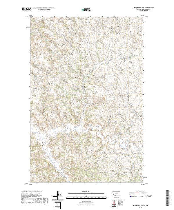
2024 Map of Seventynine Coulee
USGS Topo · Published 2024About this map
Lodgepole Creek and its many winding tributaries define the drainage patterns of this central Montana landscape. The area is characterized by a complex system of coulees, including the namesake Seventynine Coulee and the extensive Seventynine Creek, which branch out across the Garfield County terrain. While largely open land, the map identifies the location of Herron, providing a specific point of reference for local historians or genealogists interested in this corner of the state. Distinctive topographical features such as Finley Butte and Blue Ridge offer prominent landmarks above the draws of Bratten Coulee and North Kirby Coulee. This 2024 data reflects a modern survey of the Public Land Survey System, showing township boundaries from T17N to T19N. The presence of Finley Spring highlights the vital importance of water sources in this dry, channeled environment.
Find a feature on this map
21 named features on this map. Tap any name to fly to it.
Don’t see what you’re looking for? This feature index may not catch every label — zoom into the map to look around manually.
Map Details
Editions of this 2024 Seventynine Coulee Map
This is the sole edition of this map. No revisions or reprints were ever made.
Other maps of this area

1954 · Jordan
USGS Topo · 1:250,000

1956 · Jordan
USGS Topo · 1:250,000

1958 · Jordan
USGS Topo · 1:250,000

1964 · Jordan
USGS Topo · 1:250,000

1965 · Germaine Coulee East
USGS Topo · 1:24,000

1965 · Germaine Coulee West
USGS Topo · 1:24,000

1965 · Cap Rock Butte
USGS Topo · 1:24,000

1967 · Nelson Coulee
USGS Topo · 1:24,000
1967 · Searl Coulee
USGS Topo · 1:24,000
1967 · Lelig Coulee
USGS Topo · 1:24,000