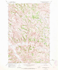
1967 Map of Seventynine Coulee
USGS Topo · Published 1971About this map
Mecaha and the Seven W Ranch mark the sparse human footprint across this Garfield County landscape, where the drainage patterns of the Missouri River breaks define the local geography. The area is characterized by a dense network of coulees, most notably Seventynine Coulee and Sherman Coulee, which carve through the high plains. Vital water sources like Herron Springs and Finley Spring provided essential anchors for ranching operations in this arid environment during the late 1960s.
Find a feature on this map
20 named features on this map. Tap any name to fly to it.
Don’t see what you’re looking for? This feature index may not catch every label — zoom into the map to look around manually.
Map Details
Editions of this 1967 Seventynine Coulee Map
This is the sole edition of this map. No revisions or reprints were ever made.
Other maps of this area

1954 · Jordan
USGS Topo · 1:250,000

1956 · Jordan
USGS Topo · 1:250,000

1958 · Jordan
USGS Topo · 1:250,000

1964 · Jordan
USGS Topo · 1:250,000

1965 · Germaine Coulee East
USGS Topo · 1:24,000

1965 · Germaine Coulee West
USGS Topo · 1:24,000

1965 · Cap Rock Butte
USGS Topo · 1:24,000

1967 · Nelson Coulee
USGS Topo · 1:24,000
1967 · Searl Coulee
USGS Topo · 1:24,000
1967 · Lelig Coulee
USGS Topo · 1:24,000