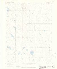
1960 Map of Severance
USGS Topo · Published 1973About this map
Severance sits at the heart of this Weld County landscape, where the agricultural and industrial needs of Northern Colorado converge. The presence of the Great Western railroad highlights the importance of transportation for the local economy during the mid-twentieth century. Water management is the defining characteristic of the terrain, visible through a dense network of reservoirs and irrigation features such as Black Hollow Reservoir, Windsor Reservoir, and Great Reservoir.
Find a feature on this map
20 named features on this map. Tap any name to fly to it.
Don’t see what you’re looking for? This feature index may not catch every label — zoom into the map to look around manually.
Map Details
Editions of this 1960 Severance Map
3 editions found
Other maps of this area

1902 · Greeley
USGS Topo · 1:125,000

1908 · Eaton
USGS Topo · 1:125,000

1910 · Eaton
USGS Topo · 1:125,000

1950 · Greeley
USGS Topo · 1:24,000

1950 · Windsor
USGS Topo · 1:24,000

1950 · Bracewell
USGS Topo · 1:24,000
1951 · Bracewell
USGS Topo · 1:24,000

1954 · Greeley
USGS Topo · 1:250,000

1957 · Greeley
USGS Topo · 1:250,000

1958 · Greeley
USGS Topo · 1:250,000