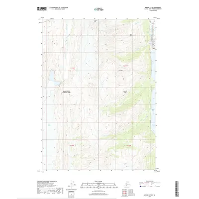
2017 Map of Seward A-7 SW
USGS Topo · Published 2017About this map
Seward serves as the primary focal point of this coastal Alaska survey, marking the southern terminus of the Seward Highway. The town's grid is detailed through named corridors such as First Avenue and Fifth Avenue, while the northern residential area is shaped by the presence of The Lagoon, First Lake, and Second Lake. To the south, Lowell Point Road follows the coastline towards the settlement of Lowell Point, bordering the eastern edge of Kenai Fjords National Park. High-elevation landmarks like Phoenix Peak, Marathon Mtn, and Bear Mtn dominate the interior landscape, overlooking drainage systems like Spruce Cr and Tonsina Cr. The coastline is further defined by geologic features such as Race Point, Tonsina Point, and the inlet of Derby Cove, while the western reach of the map is defined by the massive footprint of the Bear Glacier.
Find a feature on this map
32 named features on this map. Tap any name to fly to it.
Don’t see what you’re looking for? This feature index may not catch every label — zoom into the map to look around manually.
Map Details
Editions of this 2017 Seward A-7 SW Map
This is the sole edition of this map. No revisions or reprints were ever made.
Other maps of this area

1946 · Blying Sound
USGS Topo · 1:250,000

1950 · Seward A-8
USGS Topo · 1:63,360

1950 · Blying Sound D-7
USGS Topo · 1:63,360

1950 · Seward A-7
USGS Topo · 1:63,360

1951 · Blying Sound
USGS Topo · 1:250,000

1951 · Seward
USGS Topo · 1:250,000

1951 · Seward A-7
USGS Topo · 1:63,360
1951 · Blying Sound D-8
USGS Topo · 1:63,360

1951 · Blying Sound D-7
USGS Topo · 1:63,360

1951 · Seward A-8
USGS Topo · 1:63,360