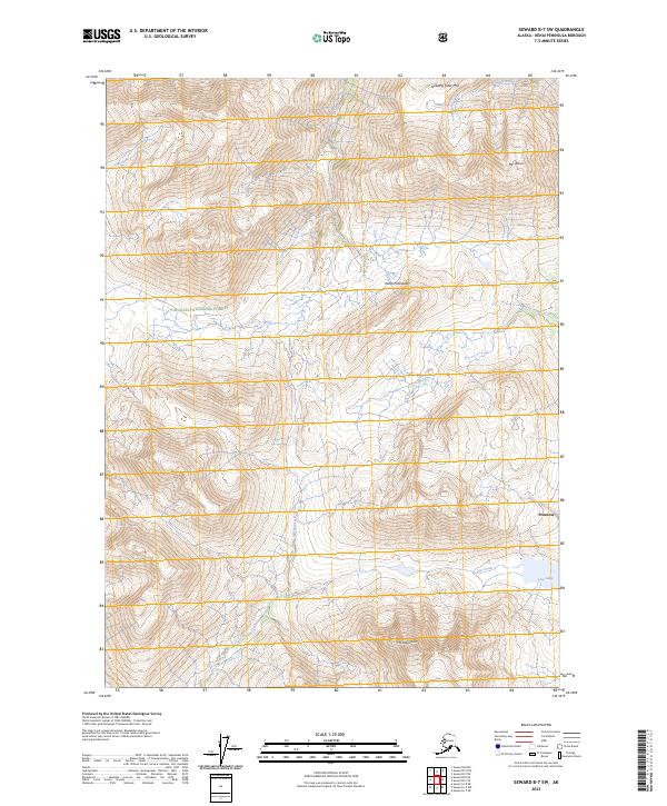
2023 Map of Seward B-7 SW
USGS Topo · Published 2023About this map
Chugach National Forest encompasses the high-altitude terrain of the Kenai Peninsula shown in this modern survey. The landscape is defined by massive peaks including Mt Ascension and Mt Adair, with Sleeping Sister Mtn standing at the northern boundary. Settlement is limited to Primrose in the southeast, where the drainage of Primrose Creek meets the lower elevations. The map details a complex drainage system where Ship Creek and Martin Creek flow through deep glacial valleys. To the south, Lost Lake and its outlet at Lost Creek provide a focal point for the high mountain basin. This contemporary topographic record captures the transition between the rugged interior peaks and the small pockets of development along the peninsula's established corridors.
Find a feature on this map
16 named features on this map. Tap any name to fly to it.
Don’t see what you’re looking for? This feature index may not catch every label — zoom into the map to look around manually.
Map Details
Editions of this 2023 Seward B-7 SW Map
This is the sole edition of this map. No revisions or reprints were ever made.
Other maps of this area

1950 · Seward A-8
USGS Topo · 1:63,360

1950 · Seward A-7
USGS Topo · 1:63,360

1951 · Seward
USGS Topo · 1:250,000

1951 · Seward A-7
USGS Topo · 1:63,360

1951 · Seward B-7
USGS Topo · 1:63,360

1951 · Seward B-8
USGS Topo · 1:63,360

1951 · Seward A-8
USGS Topo · 1:63,360
1952 · Seward A-8
USGS Topo · 1:63,360
1952 · Seward B-8
USGS Topo · 1:63,360

1953 · Seward B-7
USGS Topo · 1:63,360