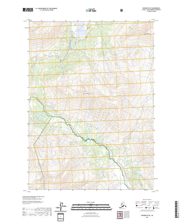
2023 Map of Seward B-8 SE
USGS Topo · Published 2023About this map
Kenai Mountains peaks dominate this high-elevation Alaskan wilderness, where numerous glaciers and drainage systems converge within the Chugach National Forest and Kenai Fjords National Park. The landscape is defined by its dramatic relief and the intricate network of water bodies, including Cooper Lake in the north and the wide valley of the Resurrection River winding through the southwestern portion of the sheet. This terrain serves as a vital corridor for primitive travel, evidenced by the established Russian Lakes Trl and the Resurrection River Trl.
Find a feature on this map
19 named features on this map. Tap any name to fly to it.
Don’t see what you’re looking for? This feature index may not catch every label — zoom into the map to look around manually.
Map Details
Editions of this 2023 Seward B-8 SE Map
This is the sole edition of this map. No revisions or reprints were ever made.
Other maps of this area

1950 · Seward A-8
USGS Topo · 1:63,360

1950 · Seward A-7
USGS Topo · 1:63,360

1951 · Seward
USGS Topo · 1:250,000

1951 · Seward A-7
USGS Topo · 1:63,360

1951 · Seward B-7
USGS Topo · 1:63,360

1951 · Seward B-8
USGS Topo · 1:63,360

1951 · Seward A-8
USGS Topo · 1:63,360
1952 · Seward A-8
USGS Topo · 1:63,360
1952 · Seward B-8
USGS Topo · 1:63,360

1953 · Seward B-7
USGS Topo · 1:63,360